ފައިލު:Bhutan-divisions-numbered.png
No higher resolution available.
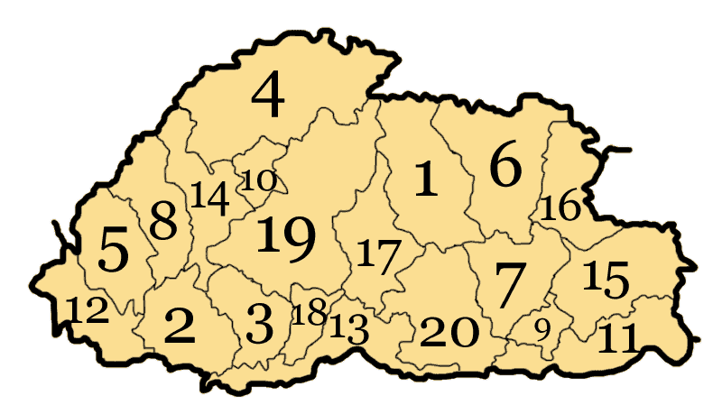
Bhutan-divisions-numbered.png (800 × 449 pixels, file size: 20 KB, MIME type: image/png)
Bhutan subdivisions numbered
Drawn by me, Nichalp
| I, the copyright holder of this work, release this work into the public domain. This applies worldwide. In some countries this may not be legally possible; if so: I grant anyone the right to use this work for any purpose, without any conditions, unless such conditions are required by law. |

|
This locator map image could be re-created using vector graphics as an SVG file. This has several advantages; see Commons:Media for cleanup for more information. If an SVG form of this image is available, please upload it and afterwards replace this template with
{{vector version available|new image name}}.
It is recommended to name the SVG file “Bhutan-divisions-numbered.svg”—then the template Vector version available (or Vva) does not need the new image name parameter. |
derivative works
Derivative works of this file:
ޞަފްޙާގެ ތާރީޚް
Click on a date/time to view the file as it appeared at that time.
| ތާރީޚް/ގަޑި | ތަމްބްނެއިލް | Dimensions | މެމްބަރު | ޚިޔާލު | |
|---|---|---|---|---|---|
| މިހާރު | 10:38, 10 އޮގަސްޓު 2005 | | 800 × 449 (20 KB) | Nichalp | correcting error |
| 00:05, 9 އޮގަސްޓު 2005 |  | 800 × 449 (18 KB) | Nichalp | Bhutan subdivisions numbered Drawn by me, ~~~ {{PD-self}} category:Maps of Bhutan |
ފާލަންތައް
The following page uses this file:
Global file usage
The following other wikis use this file:
- Usage on ar.wikipedia.org
- Usage on azb.wikipedia.org
- Usage on bo.wikipedia.org
- Usage on br.wikipedia.org
- Usage on cv.wikipedia.org
- Usage on da.wikipedia.org
- Usage on de.wikipedia.org
- Usage on en.wikipedia.org
- Usage on es.wikipedia.org
- Usage on fi.wikipedia.org
- Usage on fo.wikipedia.org
- Usage on fr.wikipedia.org
- Usage on he.wikipedia.org
- Usage on id.wikipedia.org
- Usage on ja.wikipedia.org
- Usage on ko.wikipedia.org
- Usage on ku.wikipedia.org
- Usage on lt.wikipedia.org
- Usage on nl.wikipedia.org
- Usage on no.wikipedia.org
- Usage on pl.wikipedia.org
- Usage on pl.wikivoyage.org
- Usage on ro.wikipedia.org
- Usage on sq.wikipedia.org
- Usage on sr.wikipedia.org
- Usage on trv.wikipedia.org
- Usage on vi.wikipedia.org